
![]()
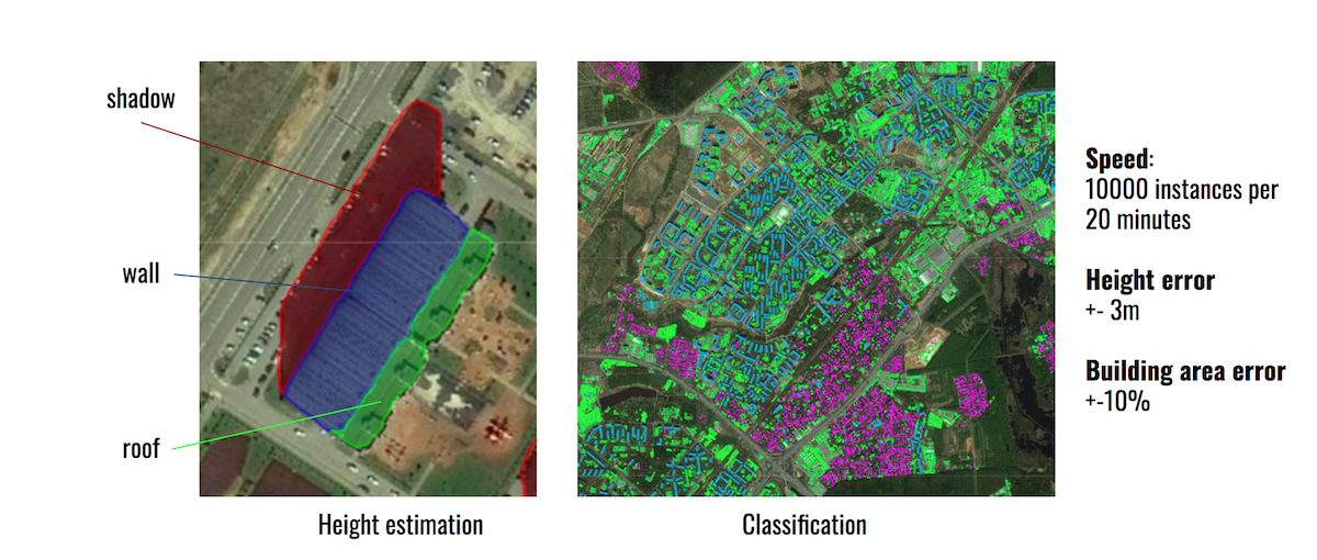
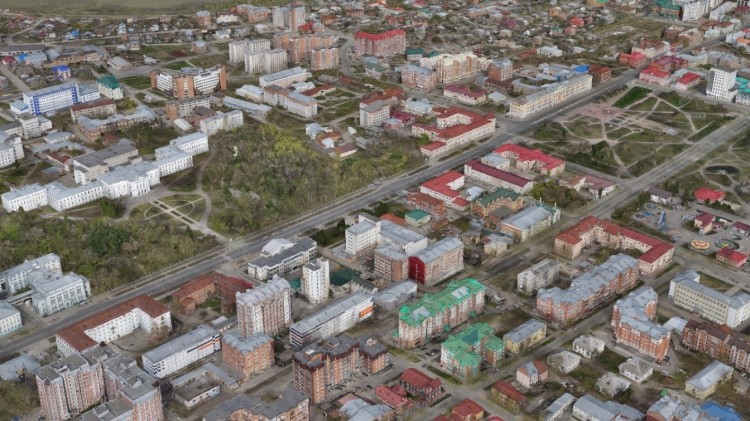
Быстрая динамика городских территорий обусловлена инвестиционными решениями. Рынки застройки могут быть исследованы с помощью методов сегментации экземпляров и обнаружения изменений - для оценки и классификации зданий и оценки численности населения. Мы применяем фотограмметрию и косвенные методы для реконструкции высоты зданий и отличия одного типа от другого.
Наши прикладные работы включают раннее обнаружение и мониторинг лесных пожаров, классификацию потерь деревьев. Мы сотрудничаем с IoT Lab в Сколтехе, предлагая новые комбинированные измерения с помощью различных датчиков. Наше партнерство с Planet Inc. позволяет создавать и внедрять уникальные модели данных для мониторинга лесного хозяйства.
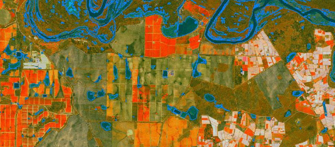
Мы используем алгоритмы, основанные на моделях глубокого обучения, для классификации сельскохозяйственных культур и выявления аномалий в росте растительности. Сотрудничая с промышленными партнерами и поставщиками данных, мы внедряем ML в реальные бизнес-процессы сельского хозяйства.
Мы активно занимаемся исследованиями в области обнаружения изменений и распознавания объектов на спутниковых и аэрофотоснимках с целью снижения рисков и оптимизации работ для компаний-операторов трубопроводов.
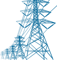
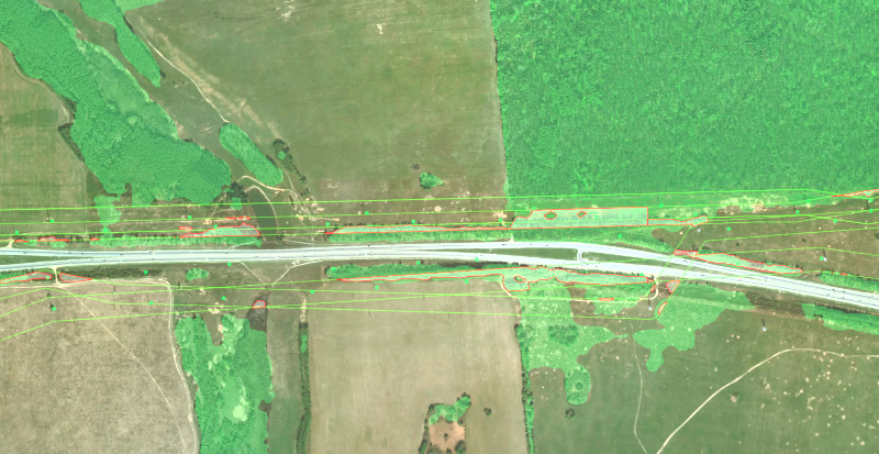
Использование различных источников коммерческих спутниковых данных позволяет нам объединить данные для достижения максимального покрытия с оптимальной скоростью. В текущем исследовании мы сосредоточились на зарастании просек ЛЭП для решения задач расчистки и контроля.
Компания Geoalert предоставляет геоинформационную платформу, которая обеспечивает автоматический анализ данных наблюдения Земли с помощью предварительно обученных алгоритмов машинного обучения. С помощью платформы Geoalert клиенты могут настраивать задачи по распознаванию объектов и определять интересующую их территорию для получения аналитики по последним данным наблюдений Земли.
Посмотрите, как это работает в приложениях:
Мы используем данные, предоставляемые ведущими мировыми спутниковыми операторами, а также данные, полученные местными компаниями, занимающимися аэрофотосъемкой.
Наблюдение Земли и машинное обучение - шумиха закончилась, теперь это будет реальное ценностное предложение.
Мы провели два семинара в рамках вводного курса Космического центра «Основы дистанционного зондирования».
Следующая серия будет организована в начале лета 2025, если вы хотите принять в ней участие - пожалуйста, свяжитесь с нами.
Уже десятки веб приложений используют наши разработки и технологии распознавания объектов.
Новая модель для обнаружения и мониторинга лесов
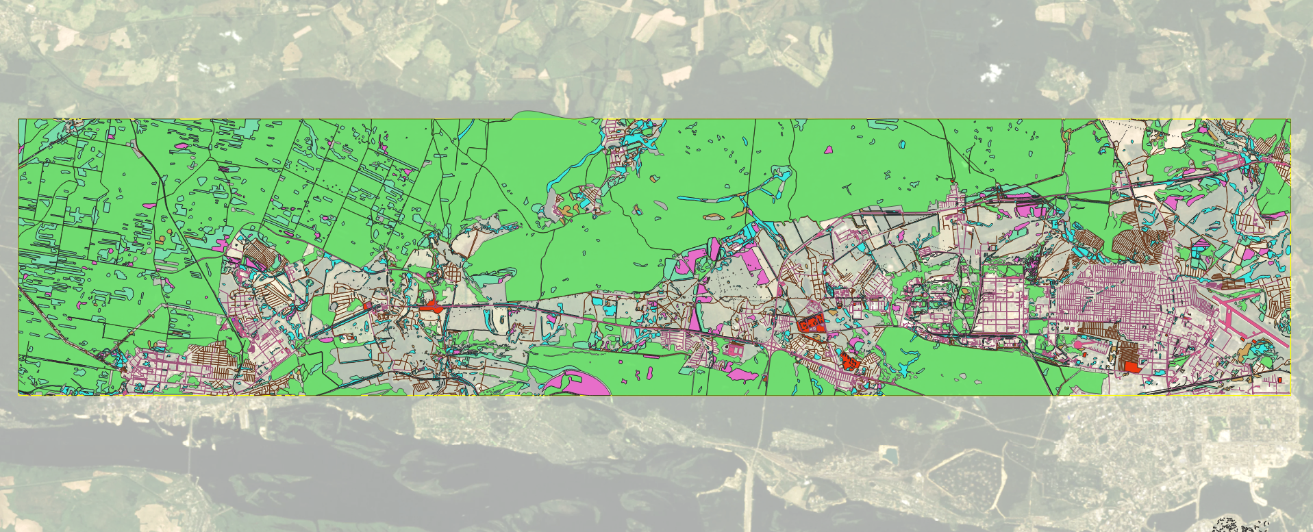
В рамках проекта «Цифровая модель Татарстана» создана новая модель для сегментации леса. Модель будет использоваться для выявления таких явлений, как зарастание просек для охранных зон линий электропередач. Она настраивается под разное разрешение и была протестирована, в частности, на снимках SPOT (1,5 м) с NIR - для применения к мозаике SPOT на всю территорию Татарстана.
Служба открытых наборов данных
Мы начали публикацию первых наборов данных «Открытого набора пространственных данных» - каталога маркированных спутниковых/аэрофотоснимков для приложений машинного обучения.
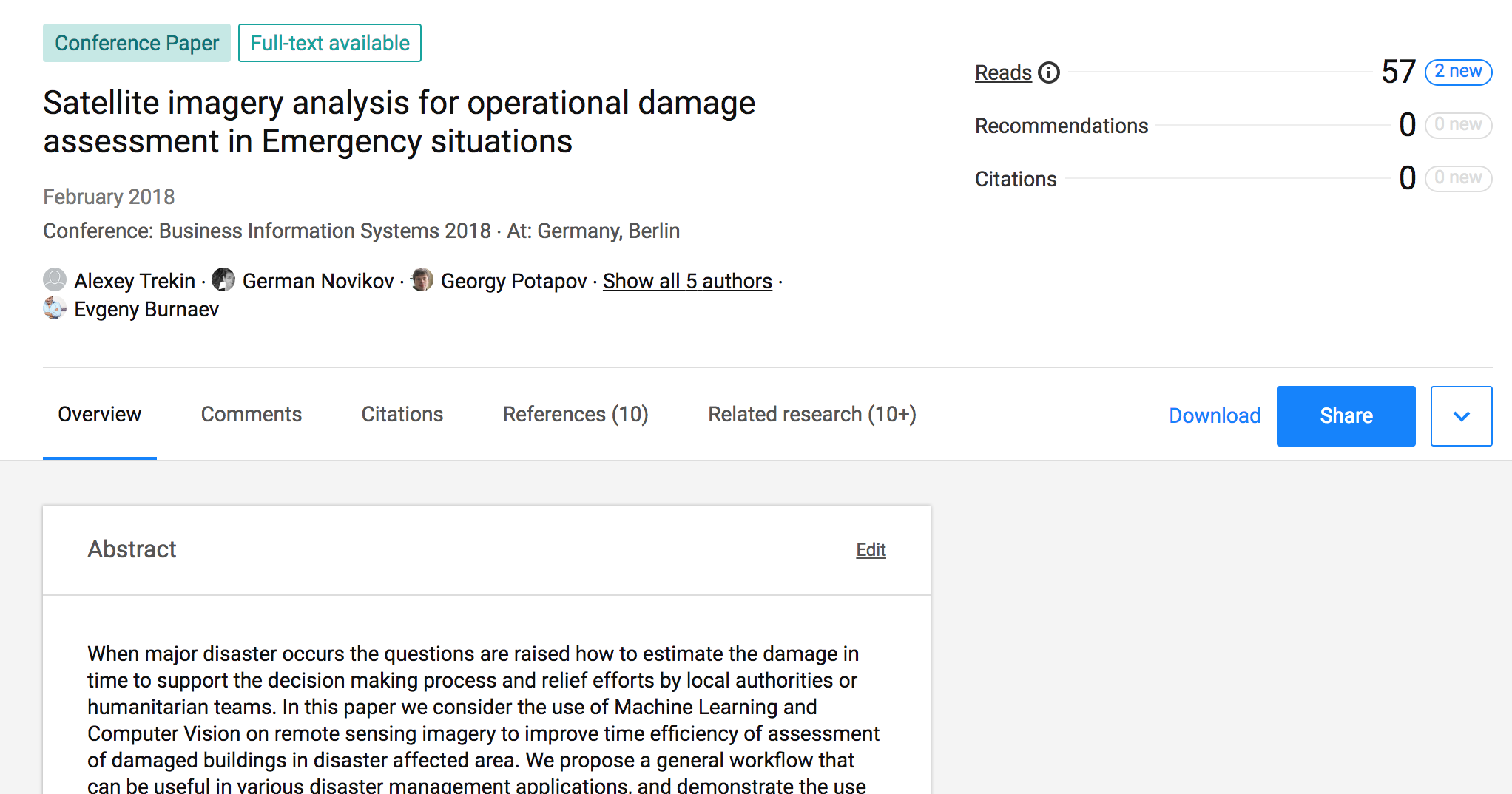
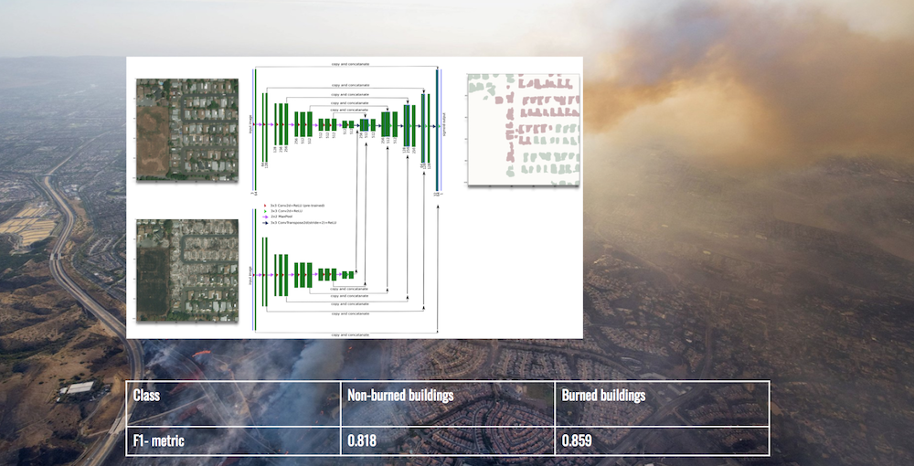
Модель, основанная на спутниковых снимках Digitalglobe, предназначена для картографирования чрезвычайных ситуаций с целью обнаружения изменений в городской инфраструктуре после стихийных бедствий. Она содержит базовую модель для сегментации поврежденных домов в жилых районах Калифорнии.
Для получения набора данных посетите нашу страницу на github.
 Смотрите нашу страницу на github